Wednesday, July 19, 2006

Hisstology - Scientific study of snakes, cats, and leaky tires

I figured out why I could not see anything the evening before when driving to the camp site. I was in the deepest canyon in the United States. I woke up to see a continuous valley of never ending cliffs that were thousands of feet high. Umm...wow! I headed to the road's end so that I could get a head start on the day hiking crowd towards the Misty Falls. As I was hiking along, minding my own business, I suddenly caught some movement and looked up to see a doe heading down the trail, seemingly in his own little world, not more than 15 feet from me. We just glanced at each other for a while as I slowly slid my camera from the case. Like the previous deer encounter, it seemed to determine quickly enough that I wasn't a threat and simply trudged off to the side to nibble on some of the local flora. I watched it for about 10 minutes as I took some pictures before decided to continue on my way. It was about four miles from the trail head to Misty Falls, but it was pretty enjoyable and a offered great views of the towering canyon walls. The falls were indeed aptly named since there was a continuous spray come from the lower section. I hiked up to the top and sat right on the river and watched the water go by for a while. I don't know why, but even after seeing so many water falls, I still do not get tired of them and can be still for a long time and just enjoy the sights and the sounds. Maybe in another life I was just an oxygen and couple of hydrogen atoms.

Not too far from the spot where I saw the doe, I came across a fawn that was heading up the trail as I was heading back towards the parking area. Like the encounter I had in Grand Sequoia National Park, the little guy was skittish and didn't hang around long enough to get too many shots, but it was still cute to see it nimbly bunch among the boulders. The thing that wasn't cute was my next animal encounter. I was walking along a wooded section of trail and heard something that immediately kicked in my adrenaline. It is mazing to me as how time can seem to slow down and one can have full thoughts or debates with oneself in a span of a second. What I heard was a quite distinctive rattle somewhere to my left. I later found it funny when I realized that my first thought was 'That is a red dot animal!'. When I was at the St. Diego zoo, I spent a little bit of time in the reptile house. Among in the display cases that were interpretive signs that described the animal inside. Some of the signs had a red dot indicated that animal to be poisonous. At this point I have no problem admitting that my first reaction was to quickly jump to my left onto a large rock like an old lady would if there was a mouse in the room. it took me a few moments to locate the rattlesnake as it was sitting less than three feet from the trail. after getting a few shots, I headed back and took the footbridge across the river towards the Bobbs Creek Trail. Just on the other side of the river was a trail that paralleled the one I took up. It was devoid of any other hikers; which was enjoyable since the falls trail was starting to get busy. The whole trip was only about 8.5 miles and offered some outstanding views of the valley meadows. Since I was only a hundred feet or so from the base, there were several massive rocks, some literally larger than my house scattered throughout the trail that at one time had fallen from the towering cliffs. One the way out I stopped by the Roaring River Falls (which looked more like a series of chutes than falls) and Grizzly Falls.

The last stops in the park were the Chicago Tree Stump and the General Grant Grove. It is a bit sad that the stump is all that remains of a 3200 year old giant Sequoia that was cut down in the 1890s and taken for displaying to the Chicago World's Fair. This was done since no one would believe, at that time, the stories of how large the trees of California could get. This act even seemed to be in vain sense most people reportedly, even after seeing the reassembled tree, assumed that it was still just a hoax. It is a shame that any of these trees were ever cut down since the wood is too brittle the even use in construction whereas barely 50% of the cut wood even making it to the mill. On the way back to the car, I had my second rattlesnake experience of the day. After the previous encounter, I was keeping a much better eye on the ground and was able to spot this large snake sitting just to the side of the path before I reached it. I'm guessing that it was probably about twice the size of the previous one and decided to wait quite a while before attempting to run by. I am glad to have gotten exposure to some of the wildlife during the hikes so far, but there are still a few animals that I could probably do without getting too close. The General Grant Tree is the second largest tree in the world and was even given the distinction of the nation's Christmas train in the 1920s. The rest of the trees along the nature walk were just as impressive and it was nice to get a last good look of these majestic guardians of the valley.

After leaving the park I decided to head over to Yosemite which was about 120 miles away. Unfortunately, that involved driving up and down a lot of very windy roads as well as going through Fresno. I'm not sure if anyone had been checking out the news recently,y but that area of the state had been having some of the highest temperatures ever recorded over the past few days. Even when I was driving through around six o'clock in the afternoon, the temperature was 106°F. It was quite a change win the highest temperatures I had recently seen in the mountains was about 86°. I stopped just long enough to hit a buffet since I was pretty hungry after hiking over the past few days and to get some fruit and water for the trails.

Tuesday, July 18, 2006

Defend the right to keep and arm bears!

After doubting whether I should go on yesterday, I'm definitely glad I decided to push myself. I ran out of water last night and didn't have enough for dinner and just drained what I had before falling asleep. I finally reached Heather Lake after about a mile and purified some water for breakfast and then filled my hydration pack and water bottles while cooking. I love a breakfast with a few, and having several hundred feet of cliff reflected in the lake while warming in the morning sun is definitely the way to do it. After finally getting in some food to hopefully replace some of the burned energy from the Alta Peak trail,I headed towards Pear Lake after stashing my pack and just keeping my hydration pack, camera, and water filter. The hike down the valley was great as I passed a few hikers (including one couple that looked well into their 70s) that were coming back from their own overnight trip. The walk from camp to Pear Lake was only 2.5 miles with only about 500 feet of lose and gain, but it was an exquisite view! Here there were a lot more snow banks with the side of the mountains and even the waters edge still fairly well covered. I was briefly tempted to take a quick dip, but figured if the snow is still right up to the edge of the lake, then biting cold might just barely describe the feeling. Good for drinking, bad for swimming and surviving.

At both Emerald Lake and Pear Lake there were a bunch of marmots running around. These beaver-looking animals are said to be just as much of a bother concerning food as are the black bears! I found it funny how I was happy hitting a 11K summit a week or so ago and now I'm sitting at the edge of a fair sized lake at 10 feet looking at cliffs rise hundreds of more feet to their peaks. This was a great place for reflection (no pun intended) and I totally lost track of time while sitting on there on the edge of the world. After watching the marmots scurry around for a while trying to figure out of I had food anywhere near or on me I decided to head back. I grabbed my pack again and took the Watchtower Trail instead of the Hump Trail for the return leg. I was again reminded of a few scenes from the 'Lord of the Rings' movie. The trail was quite interesting since for about a half mile it ran along a ledge that was only about three feet wide in some spots with the edge dropping about a sheer 800 feet with the valley floor about 1200 feet down. It was especially fun when a light rain started dropping for 10 minutes or so. The watchtower itself was a large outcropping that jutted off the mountainside that immediately, of course, reminded me of the ring wraith scene on Amon Sûl from the first movie. After see the razor ridge edge and sheer drops on either side, I decided against any foolhardy climbs. One the way back, I caught sight of a doe and her fawn feeding on the trail as I was going over a crest. It was raining a bit, but I was able to get the camera out and keep it fairly protected as I watched them (and wished I carried the telephoto lens). The fawn was quite skittish, but the doe seemed to be fairly unconcerned, though would look up every now and again. After they took off I finished the trail and took the junction back to the car. The total length of the trail, including the 4 mile detour, was about 25 miles over two days. What an awesome hike!

When driving back to the ranger station, I saw a van pulled over to the side of the road with a family looking excitedly into the woods. I parked behind them and saw that the focus of their attention was a tagged (#72) black bear forging around. After carrying that darned heavy bear canister for that trail I just finished, I was expecting to get something for it. I gabbed the camera and was able to get a few shots as it stumbled around. The auto focus was useless because of all the brush in the foreground and background, but I got a few decent shots in. after it went out of sight the family took off, but I waited around for a while hoping it would come out. After about 5 minutes, I saw it come into view as it was looking around and even saw it as it crossed the road. the rain was coming down pretty hard, so I could only get some shots from inside the car. It was interesting to watch it forage around and tear up old tree trunks and shrubs looking for whatever it was wanting. After a while it meandered deep into the woods, so I resumed the trip to the ranger station to turn in the canister and take advantage of the public showers. Though they charged, I think the $2 for the 8 minute shower was money quite well spent. Getting shaved and cleaned up can be a very refreshing feeling and even though I was tired before, I felt a bit energized.

I headed out of the National Park and into the boundaries of the National Forest on the way to the King's Canyon section. I found, via the GPS, a few dirt roads that looped around the forest a bit and took a little bit of time to do some semi-off roading and was surprised as to how well the vehicle handled some of the bumps and gullies. Hmm, maybe I should have definitely gotten the full insurance package! I then headed over to Buck Rock for a while to take in one of the other best viewpoints in the area. This is the site of one of the other active fire lookout towers (like the Needles Lookout) and I was able to make it just under the wire before the public viewing was closed for the evening. I had a nice conversation with the tenant there and just stood around for a while looking at the sweeping landscape as he monitored a few hot spots in the distance. There was a feeder that was being actively used by 2-3 hummingbirds that allowed me to get a chance to take pictures of their hovering and darting around. Even with a fast shutter speed and auto-release I couldn not nearly begin to capture their wing speed.

As dusk was coming in fast, I headed over to Hume Lake to take a look around since it was right on the way to my next destination. There were some nice trails along the lake shore and I enjoyed walking around for a bit as the evening colors set in as the sun began its sleep behind the mountain. After it got dark and the long driving on a very windy road (though I could not see anything outside of headlight range, I head towards King's Canyon and stopped in at the Convict Campground just before getting to the National Park border. There was no one else on the entire property since it really consisted of little more than some tables, an outhouse, and a few paved back-in camping spaces. Cooking was an eerie feeling since it was nearly pitch black. There was no moon nor a single bit of artificial light within view, not even a city glow. The stars, however, were amazing. Since I was cooking with my red light, I was able to lie out and gaze up at the galaxy of stars to such a degree as I do not think I have been able to see since boating in the Dry Tortugas when about 60 miles from shore.

Where will the next adventure be? Second star to the right and straight on until morning!

Monday, July 17, 2006

The reason lightning doesn't strike twice in the same place is that the same place isn't there the second time.

After waking up, I continued along the trail and occasionally thought it was strange to be going downhill the whole time to get to the peak, but figured it was something like the Needles Lookout trail where there was a few thousand feet of drop before the trail climbed back up the mountain to the tower. It wasn't until I got to the next trail sign that I realized my mistake. The sign pointed out that the trail I thought I was on was 2.2 miles back the way I came; and yeah, it was straight up. Nothing to do but head back. Once I got to the trail head again, I realized how I missed the trail in the dark and then set off in the right direction, grumbling at the lost time. I even soon came across the meadow for which I had been searching the evening before. At the next trail head I decided to stash some of the heavy stuff (tent, bear canister, stove, etc.) behind some rocks to make the load lighter for the hike to the summit, another 2 miles away with 1900 feet of elevation gain.

As I was climbing up, I was getting my first exposure to snow in countless years. Even though hiking was comfortable in shorts and a thin shirt and even sleeping just required to silk long underwear to stay comfortable, the snow still found ways to survive on the mountain side in a bunch of different mounds scattered all over. And no, even though none of it was yellow, I was not tempted to eat the snow. When I was about 600 feet in elevation from the top a storm seemed to be coming in, so I sought shelter in a small rock outcropping. Until I fell asleep (after leaving my trekking poles and external framed pack outside of course), it was cool to watch the lightning dance around the valley in the distance. When I woke up a hour or so later there was still some thunder, which I assumed to be of the storm that passed in the distance. I kept hearing it as I continued my climb and thought it was just canyon echoes. Not until I got to the summit did I realize what was happening. I scrambled over the rock and got my first view of the other side of the mountain and subsequent valley. What I was hearing wasn't the storm that already went by, it was another storm that was coming in on the heels of the first one. I had just enough time to put the camera on auto-trigger and just hold down the release while spinning around. I got some decent panorama pictures put together (check out the slide show below) and you can really see the coverage of the storm system. I then saw lightning that seemingly traveled up to a cloud that was either just about level of just below me. Just at that point I smelled what seemed to be some distinctive ozone. Being about 1000 feet above the tree line in that weather is not fun. I have never run so fast down a mountain in my life and am surprised I didn't wipe out on some of the snow patches. If I checked the barometer beforee starting up again I might have figured it out, but I didn't even think about it after waking up and assuming the system had already passed. The storm never reached my side of the mountain and about 30 minutes later the sky seemed to be a crisp blue. I really would have loved to take in more of the view and will hope to get another crack at it (no pun intended) sometime.

After picking my stuff back into the pack, I headed back towards Panther Gap. After the day activities, I was almost considering heading back to the trail head and forgoing the next leg, but decided to keep going. I wanted to get to Emerald Lake and headed towards Pear Lake via The Hump trial, but after already walking 13 miles that day which had a 4900 elevation gain and and 3900 foot loss, I was exhausted and petered out about a mile before getting to Heather Lake just as darkness was setting in. that was one of the most tough days I've ever had. I knew I should have packed the Ibuprofen.

Sunday, July 16, 2006

A tree fell right in front of me in the forest, and I didn't hear it.

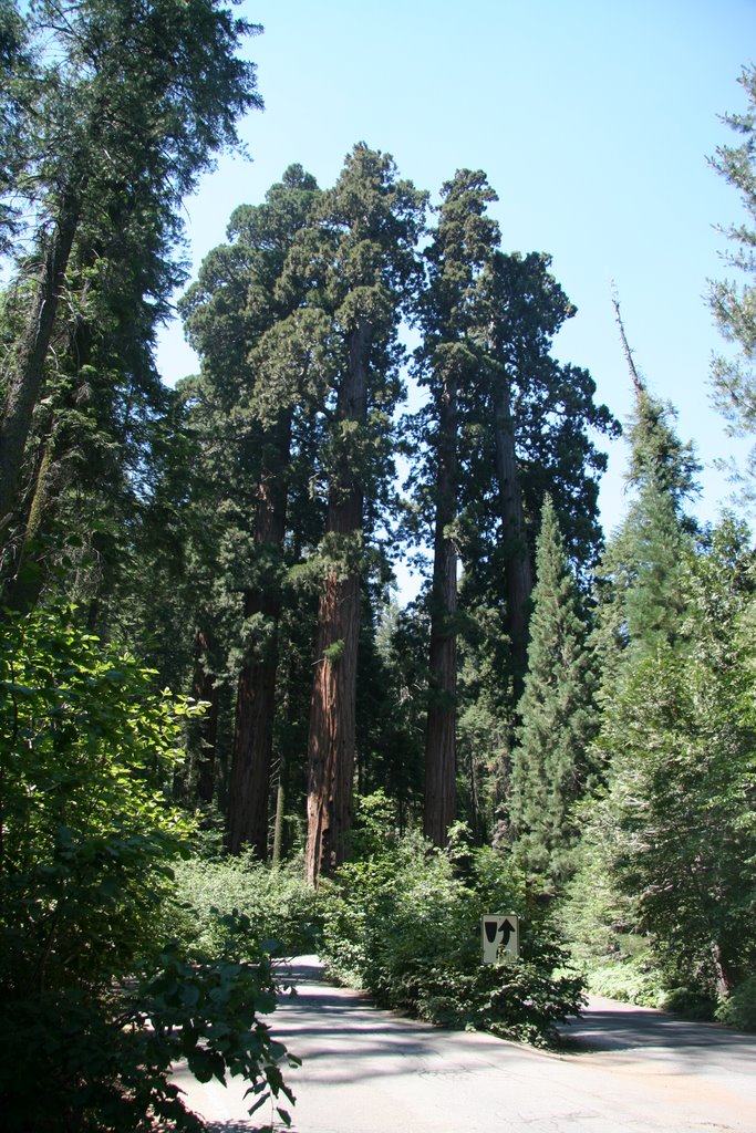
After getting to Grand Sequoia National Park, I made a stop at some of the major sites along the road such as the old 'Tunnel Rock' under which the old road used to travel before vehicles got too large to clear the roof. One was not be able to help but feel small when driving under the 'Four Generals'. These are giant sequoias that are nearly side-by-side between which the entrance road passes and gave a feel of walking between some large buildings. The next couple of days would often remind of me of scenes from the 'Lord of the Rings' movie. This drive by was likened to the scene in the first movie when the group was floating between the two huge guardian statues. Hospital Rock was neat in that it had several samples of cave paintings that were still visible on the rock while there were also numerous mortar holes (used by natives to crush acorns and such into meal) along several of the large rocks. The next stop was one of the visitor's centers to check out the Sentinel Tree. Recall that many of these trees are nearly as tall as the Statue of Liberty and are every bit as majestic as that national symbol. This is supposedly one of the only sequoias that can be photographed in whole with a common consumer camera. As I headed toward Moro Rock, the next climbing spot, for a day hike, I stopped by the sequoia Auto Log and the famous tree tunnel that was carved out to allow autos to drive through. The Auto Log fell in 1917 and had part of the 21 diameter trunk chiseled flat upon which cars could be driven and which has been used for multiple car commercials and promotions in the past.

Moro Rock was a granite dome that was like what I had been on the other day for breakfast, but the views where were even better. There was a trail pretty much carved (by the CCC) into the rock all the way to the summit, however it really didn't mean that it was any less steep of a climb. The pathway for the most part was quite narrow and I passed several people that just didn't have the nerve to go to the top. It can be nervous to slide along a decently precarious ledge with a 400-500 foot drop on the other side of the thin, low rail. The view from the top was, of course, quite nice, but after having to squeeze by a few people, I decided to make my own space and just crossed the rail and sat down for a while. Even in a crowd one can find solitude. When I was looking down from the rail, I could see a plastic chip bag that had been discarded was sitting on a rock outcropping just a few feet down the side. I went to grab it since it was in quite a stable area and had a tiny surprise waiting. I just sometimes karma can do you a favor, because a few inches from the bag was a lens cap with the canon logo on it. remember a few entries back when I said I had lost my lens cap? Well this was a 58mm cap and was exactly what I was missing on my telephoto lens!

The next stop is probably the most visited point in the entire park, the 'General Sherman Tree'. By volume, this is reported to be the largest tree (or living thing) in the world with an age of ~2300 years, 102' circumference at the base and an estimated weight of 1300 tons. Yeah, it is a big ass tree. Though I'd bet 90% of the people that visit that tree don't explore much further, the 'congress Trail' is a nice 2 mile loop that runs through several nice groupings of sequoias. The National Park Service (NPS) stopped the practice of naming trees a few decades ago, but the old labels are still kept with distinctions such as 'the Senate Group, 'The House Group', and many individual trees named after generals or presidents.

After getting my fill of tourists and pavement, I figured it was time to get out into the world I was there to see. I hit the wilderness center to pick up a hiking permit and check my supplies. Unfortunately, the NPS, requires that overnight hikes carry and use a bear-proof food canister. This was 3 pounds of heavy plastic that I did not want to carry, but there really wasn't much choice in the matter, so after renting the necessary equipment and getting the permit, I headed to the trail head parking area. It took a little while to get my pack together and then to clean out the car of everything that had a scent (food, sun block, toiletries, etc) so it could be placed in one of the large bear boxes nearby so that I wouldn't return to a shredded vehicle (hmm, I wonder if insurance covers 'acts of bear'). Being my first hiking trip to bear country, I was a bit nervous, especially after seeing large amounts of droppings the first half-mile of trail. After noticing that there were no human looking parts and seeing that it was mostly hey, I figured that it was from the horses and pack animals that are used for the high Sierra trails. My plan was to start along the Lakes Trail to Panther Gap and then camp about four miles (and 6300 feet gain) in at Mehreten Meadows for the night. The trail offered some nice views, but towards the end, I really started to get a bit tired, especially considering I had been driving and already walking and climbing about five miles throughout the day. It started getting dark and though I saw a trail sign, I could not find the meadows. I eventually had to throw up the tent a couple hundred feet of trail since it was getting pretty dark, so after the hammock set up I cooked my dinner and crashed within a minute or so of stretching out.

Saturday, July 15, 2006

Amateur geologists take limestone for granite

I got up in the morning and headed over to the next site; Sentinel Peak which was just down the road from my crash spot. The sites really were not obviously marked on the main road with it taking a bit of map work to find the locations. The National Forest, like the National Park, seems to prefer to try to keep things as rustic as possible and limits the number of distractions in the wilderness. The road led right up to the base of the dome, and since it was only a short hike to the top, I took up my Jetboil stove and oatmeal so I could have breakfast right on the top of the overlook and spent a while taking in the morning view. Sentinel Peak, like may other well known cousins such as Half Dome and North Dome in Yosemite, was formed by a geological called exfoliation.

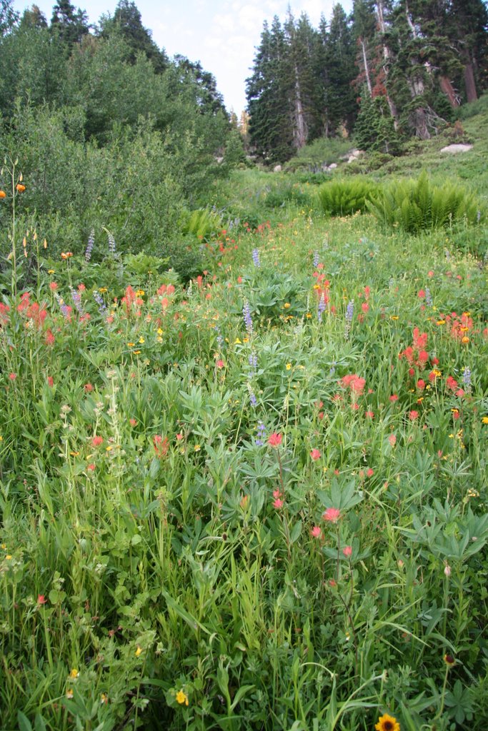
My next destination was the Needles Lookout Tower as recommended by the forest ranger and informational newsletter I got at the info station before getting to the park. It was a pretty tough 2.5 mile hike that had quite a bit of elevation gain and loss and was pretty strenuous. A couple of things struck me when visiting the site. First off was the precarious position of the tower as seen in the pictures (the one on the right being the first glimpse I had of the tower when hiking in and the other a closer view). This 14x14 space is on a very narrow ridge, but gives a sweeping overview of the entire valley. Needles Lookout was built in 1937 by the Civilian Conservation Corps and sits on a granite pinnacle. This spot definitely is not for the acrophobic and indeed several people visiting when I was there refused to even go up the stairs to the tower itself. Fortunately not many were there mid-morning, so I was able to sit down and take I the view for quite a while (only 4 people are allowed up at a time due to the tiny walking space. The other thing I found interesting was the aroma that blanketed half of the hike. The entire mountainside had a very sweet smell that either came from the covering of wildflowers or some particular plant species that I never identified. It, along with the relative cool temperature, made the whole hike quite enjoyable. While a lot of places, such as Yosemite NP have places termed ‘Inspiration Point’ or have some other majestic sounding name, I think this was a prime spot for getting such an epiphany if one was searching for one. It is hard to foresee how anything left on the trip can really top this. Thoreau should not have used 'Walden Pond' as his source for transcendentialism, he should have come here instead.

On the way out of the forest area and towards the national park I made a few stops along some of the overlooks and sites that interested me. I saw a parking area thaseemedmd pretty packed with cars and found a staircase to the valley below. Apparently this is a very popular swimming location for nearby residents and is simply called 'The Stairs'. While it was a nice area, it was unfortunately trashed beyond belief as it seems the local users will gladly carry down their bags, bottles, and charcoal bags but wouldn't give a second thought to carrying their stuff back up. I did find one spot where there was a natural water chute that was used as a water slide for a hundred feet or so. I gave it a few chances beforrememberingng that while it was a natural slide, it was also made of rock as I made a hard tailbone landing after a particularly hard drop. The water was quite cold, but pretty refreshing as well. I checked out a few other roadside caves and waterfalls before heading out.

There is a little bit of space between the Sequoia National Forest and the Sequoia National Park, so I headed over in the later part of the evening. Just before it got to the boundary, I passed an old fun park that had an old miniature golf course, bumper boats pool, old kiddie railroad, and other such toursity stuff. For some reason, I tend to like derelict sites that offer exploring opportunities, such as old ships (like subs, aircraft carriers, abandoned factories, large old hotels, etc.), abandoned factories, and old buildings. I stopped by and spent a little while walking around the old golf course (too bad I didn't carry a club and ball with me, but then again why would I?). It was neat to walk around the old golf course (and see a couple of jack rabbits hopping around), and check out the nearly dbumperber boat pool and check out the old train station that probably one ran around the old park. Since it was really close to the park anyway, I just set up my sleeping quarters, fixed myself some food and crashed. Not a bad end for a pretty nice day.

Friday, July 14, 2006

Def: Camping (n): See Heat Stroke, Mud, and Insects

The adventures definitely continue. After leaving LA I crashed just off the exit along the interstate and at some tiny town. Since I had been hiking in, running in, and generally using up most of my clothes, I decided to do some laundry. I stopped by a laundromat to defunk my trail clothes and other wears was well as charge up the batteries on my laptop, GPS, camera, and other vital technological gear. On the way to the park, I saw a sigh that indicated park headquarters/information in Porterville (just sough of the National Park). Apparently it was one of the main offices for the Sequoia National Forest, which I hadn’t even previously considered nor really was aware of the existence (of difference between parks) of it. I talked to one of the rangers for a while and explained my interests and time schedule, and she was able to provide a good list of recommendations. I was a lovely, though a bit long drive to the sites, but the place was spectacular. Along the way, I stopped at a little roadside turnout that had a small stream next to it. I had (or was pulled into) a lovely long conversation with a gentleman that was there with his wife, daughter, and grandkids doing a bit of stream fishing. We chatted for what was probably 45 minutes to an hour about different traveling experiences as he relayed some of his old experiences in the area and shared what had changed, what he had previously see, recommendations, etc. I really enjoy running into such people that enjoy sharing their experiences and felt it really added a bit of flavor to the trip.

My first stop, after actually getting to where I intended to be after all the little side stops for pictures or vista views, was the 'Trail of 100 Giants'. This was a lovely trail, though paved, that winded throughout the southernmost sequoia grove. I’ve always wanted to see these giants after reading about them and seeing pictures in Social Studies class as well as history books from the hey day of primary school. They were every bit as grandiose and prominent as I would have expected. To say, ‘big’ would not even begin to convey the magnitude of the giants. I wandered around the trail trying to take in the sheer volume and age of the living monuments. These entities were large when Nero was taking fiddle lessons as a boy or when Galileo’s head was on the block for looking up the truth. After the trail, I took the opportunity to explore the many side dirt roadways that the forest has to offer. One huge difference from the National Park system is that the National Forest (run by the Department of Agriculture vs. the park system’s Department of Interior) is that they seemingly encourage the utilization and enjoyment of the resources on a more primitive level. The NPS has everything marked, interpretatively signed, and well traversed while the Forest Service seems to enable self-exploration that allows one to feel like they really are pushing into the wilderness and not just getting a ‘Disneyfied’ version with pretty interpretive signs and iconic animals saying that only you can prevent forest fires. The little Chevy HHR that I got as a rental could handle a lot more than I expected, though with all the layered dust, I’m expecting that I’ll have to pressure wash it before I can return it to the rental agency when I’m done. Hmm, maybe I should have gotten the *full* insurance package. I found a lovely dead end right along a stream and set up my camp for the evening, even getting a few shots of my living space, for prosperity, of the next few weeks. Although seemingly small, it is a good deal more comfortable, and especially more versatile, than many motels I which I have stayed in the past.